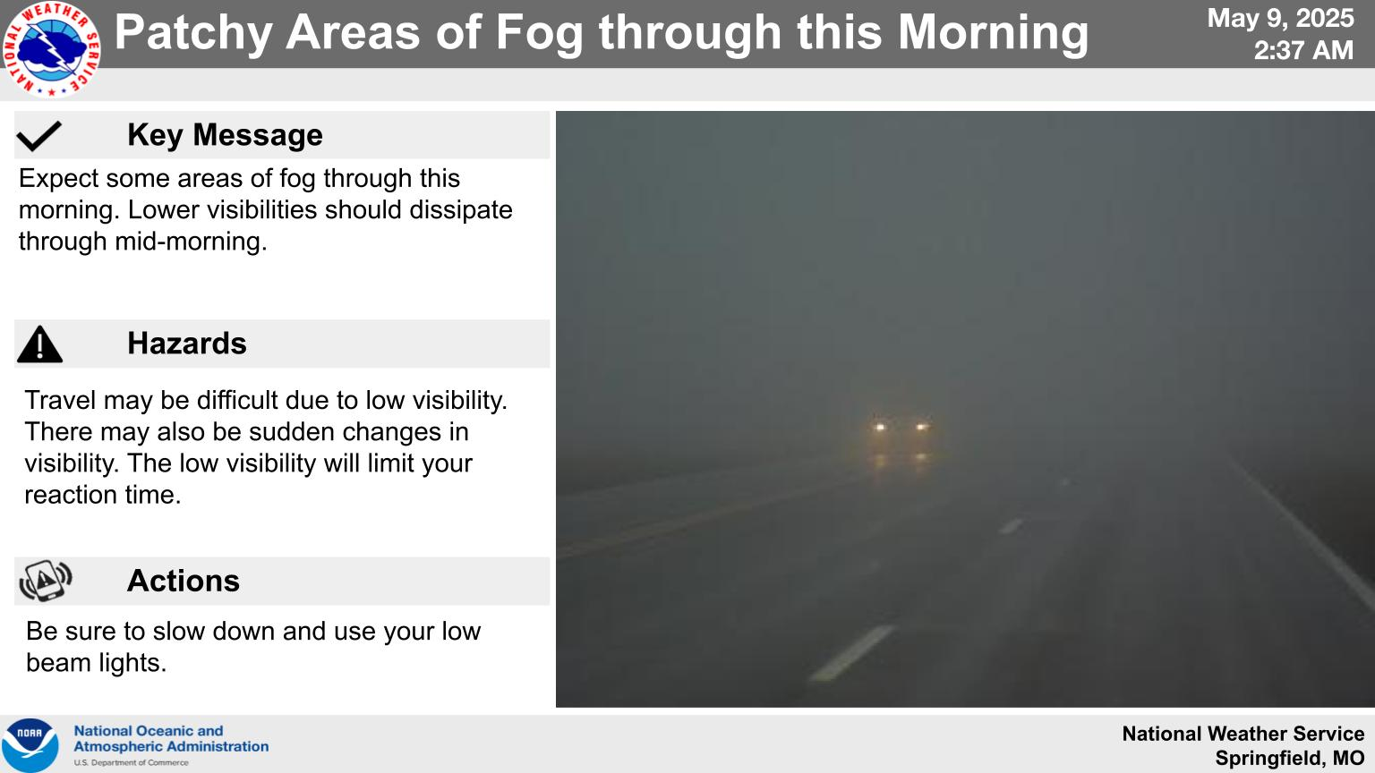
Flood Warning In Effect For Portions Of The Lake Area
Numerous rounds of thunderstorms overnight have prompted Flood Warnings to be issued across the region.
If you’re in the affected area, turn around don’t drown and avoid low water crossings until further notice.
The majority of flooded areas are starting to clear up as of Monday afternoon, however these areas remain under the warning:

...The Flood Warning is extended for the following rivers in
Missouri...

  Big Piney below Fort Leonard Wood  -East Gate affecting Pulaski
  County.

For the Big Piney River...including Fort Leonard Wood - East Gate...
Minor flooding is forecast.

PRECAUTIONARY/PREPAREDNESS ACTIONS...

Turn around, don`t drown when encountering flooded roads. Many flood
deaths occur in vehicles.

Motorists should not attempt to drive around barricades or drive
cars through flooded areas.

Additional information is available at www.weather.gov.

The next statement will be issued Tuesday morning at 815 AM CDT.


...FLOOD WARNING NOW IN EFFECT UNTIL LATE TOMORROW EVENING...

* WHAT...Minor flooding is occurring and minor flooding is forecast.

* WHERE...Big Piney  below Fort Leonard Wood - East Gate.

* WHEN...Until late tomorrow evening.

* IMPACTS...At 15.0 feet, moderate flood stage. Water at the lower
  TA 250 Training Ground is three feet deep.

* ADDITIONAL DETAILS...
  - At 7:00 AM CDT Monday the stage was 12.2 feet.
  - Bankfull stage is 8.0 feet.
  - Recent Activity...The maximum river stage in the 24 hours
    ending at 7:00 AM CDT Monday was 12.2 feet.
  - Forecast...The river is expected to rise to a crest of 14.7
    feet this evening. It will then fall below flood stage
    tomorrow afternoon.
  - Flood stage is 8.0 feet.
  - Flood History...This crest compares to a previous crest of
    14.7 feet on 02/01/1982.
  - http://www.weather.gov/safety/flood

AND
...The Flood Warning continues for the following rivers in
Missouri...

  Gasconade River at Hazelgreen affecting Laclede County.

For the Gasconade River...including Jerome, Hazelgreen...Minor
flooding is forecast.

PRECAUTIONARY/PREPAREDNESS ACTIONS...

Turn around, don`t drown when encountering flooded roads. Many flood
deaths occur in vehicles.

Motorists should not attempt to drive around barricades or drive
cars through flooded areas.

Additional information is available at www.weather.gov.

The next statement will be issued Tuesday morning at 815 AM CDT.


...FLOOD WARNING NOW IN EFFECT FROM THIS AFTERNOON TO LATE TOMORROW
EVENING...

* WHAT...Minor flooding is forecast.

* WHERE...Gasconade River at Hazelgreen.

* WHEN...From this afternoon to late tomorrow evening.

* IMPACTS...At 21.0 feet, minor flooding begins at the gage site and
  mainly affects low lying areas along the river.

* ADDITIONAL DETAILS...
  - At 7:15 AM CDT Monday the stage was 16.5 feet.
  - Bankfull stage is 21.0 feet.
  - Forecast...The river is expected to rise above flood stage
    late this afternoon to a crest of 21.5 feet this evening. It
    will then fall below flood stage late this evening.
  - Flood stage is 21.0 feet.
  - Flood History...This crest compares to a previous crest of
    21.6 feet on 06/18/1942.
  - http://www.weather.gov/safety/flood


