Winter Weather Advisory In Effect As Lake Area Sees Affects Of Winter System
A winter weather advisory is in effect across the entire Lake Region as a winter system pushes it’s way through the area.
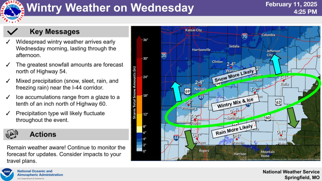
The National Weather Service is expecting a cross between snow, wintry mix & ice…all of which is riding a fine line across the Lake of the Ozarks.
They say areas around Interstate 44, including Dallas, Laclede and Pulaski Counties are expecting a wintry mix with ice, while Hickory, Camden, Miller and Maries will see 1 to 3 inches of snow.
Benton, Morgan and Moniteau counties are expecting even more, with 2-4 inches as of midnight Wednesday.
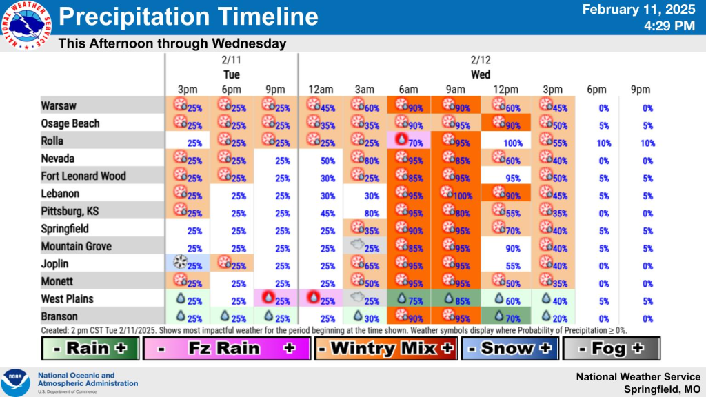
Reports from area listeners say there’s already slick spots across the lake, including ice on the Grand Glaize bridge.
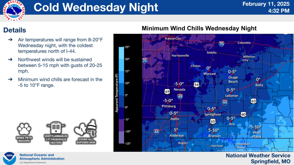
Once the system moves through, it’s expected that we will see extremely cold temperatures, including single digits to near zero degrees in areas like Warsaw.
Here’s the current update from the National Weather service on locations and timing….
…WINTER WEATHER ADVISORY REMAINS IN EFFECT UNTIL 9 PM CST WEDNESDAY…
* WHAT…Mixed precipitation expected. Total snow and sleet accumulations up to 2 to 4 inches and ice accumulations of a glaze to around one tenth of an inch. Periods of freezing drizzle will also continue to occur at times the rest of this evening into tonight and again Wednesday afternoon.
* WHERE…Portions of southeast Kansas and central, southwest, and west central Missouri.
* WHEN…Until 9 PM CST Wednesday.
* IMPACTS…Plan on slippery road conditions. The hazardous conditions could impact the Wednesday morning and evening commutes.
PRECAUTIONARY/PREPAREDNESS ACTIONS…
Slow down and use caution while traveling. In Missouri, call 1-888-275-6636 for road conditions.

Reporter John Rogger