MO DNR Working On Water Survey That Will Soon Include The Niangua River
The Missouri Department of Natural Resources has announced an initiative to help better understand water quality and quantity across Missouri.
The DNR says the Missouri Hydrology Atlas is a new mapping effort to compile technical information sources into one publication for the state’s river basins.
The first map added to the atlas covers the Sac River Basin which includes nearly 2,000 square miles across Cedar, Dade, Greene, Lawrence and St. Clair counties.
The next area to be mapped will be the Niangua River Basin beginning near Marshfield to the Osage River with more than 1,000 miles of watershed across Camden, Dallas, Laclede and Webster counties.
The hydrology atlas is being produced by the Missouri Geological Survey’s Water Resources Center and will be available online to residents and planners
More info:
Better understanding the quality and quantity of Missouri’s water is the goal of an initiative launching this year as part of the Missouri Department of Natural Resources’ Missouri Water Resources Plan.
The Missouri Hydrology Atlas is a new mapping effort to compile various technical information sources into one publication for the state’s river basins. Produced by the Missouri Geological Survey’s Water Resources Center, the maps added to the atlas will be made available online to residents and planners.
“Each year, the Missouri Geological Survey produces updated surficial bedrock maps of the state. These hydrology maps will be similar, but instead focus on what we learn about surface water and groundwater resources within our drainage basins,” said Scott Kaden, chief of the Missouri Geological Survey’s Groundwater Section. “Missouri’s borders include the entirety or portions of 66 HUC-8 (USGS Hydrology Unit Code) drainage basins. We’ll be starting with the basins that are located entirely within Missouri and plan to add at least one new map to the atlas each year.”
Kaden said the principal information reflected in the maps will pertain to springs within the basin. This will include water quality and discharge data, location of springs and any water tracing that has been conducted to delineate the recharge area of the springs. Additional surface water information will include streamgage readings and aquifer levels recorded by groundwater monitoring wells.
“The Missouri Geological Survey has identified over 4,500 springs within the state, but there are a lot of unknowns and we don’t have water quality or discharge information for many,” Kaden said. “The first step to better understanding an aquifer is knowing the amount of water moving in and out. These maps will give us an understanding of what that looks like through compiling the information we have available and collecting new information in the field.”
The first map added to the atlas is titled “Hydrology of the Sac River Basin.” The Sac River flows more than 100 miles across southwest Missouri from its headwaters near Springfield north to its confluence with the Osage River. Its watershed includes nearly 2,000 square miles across Cedar, Dade, Greene, Lawrence and St. Clair counties.
“The Sac River Basin is a good place to start, because it reflects the many different ways water serves as an essential resource for Missouri,” said Geologist Lauren Mack, who completed the Sac River Basin map.
Mack cited Stockton Lake was created by the damming of the Sac River. Springfield and the surrounding area rely on this reservoir as a major drinking water source. Stockton Dam also produces hydrologic electricity for the region. Beyond that, Stockton Lake is a major tourism and recreation center as home to Stockton State Park, as well as many other public lands and private businesses.
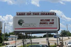
Kaden said the next area to be mapped for the atlas will be Niangua River Basin. The Niangua River begins near Marshfield and flows north for more than 100 miles to its confluence with the Osage River via Lake of the Ozarks. Its total watershed covers more than 1,000 square miles of Camden, Dallas, Laclede and Webster counties.
Contact mowater@dnr.mo.gov for more information on the Missouri Hydrology Atlas.
###
Reporter Mike Anthony